Earth globe 3 d real sizes of continents. Google Earth Interactive Earth Model
Now we will consider another virtual globe - free program Marble.
Marble is a virtual (electronic) globe. Thanks to this globe, you can learn much more about your planet and about many planets in the solar system. For example, about Venus, Mars, Saturn, Jupiter and their satellites.
Maps are designed in various styles, from road maps to climate, topographic, temperature, night lights maps. Also, it is possible to view maps in different historical periods. This applies not only to the Earth, but also to the Moon and Mars. For example, this is the Atlas of the alleged channels of Mars, compiled by Percival Lowell in 1895.
Or, the terrestrial globe of 1492. I have seen such maps only on a flat scale. Pay attention to the North Pole. Here we see the mainland, similar to the ancient Hyperborea.

Also, you can see a map of the Moon, for example, in 1645, compiled by Johannes Hevelius. As you can see from the screenshot, on the map we see a lot of lunar craters and lunar "seas". The sickle-shaped place is the dark side of the Moon, hidden from the eyes of earthlings, which was photographed only in the middle of the 20th century by a Soviet satellite.

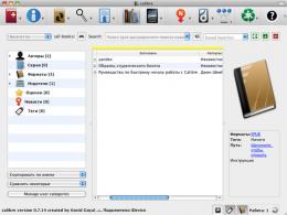
Marble how to work with the program
Marble version 2.2.0 can download from official site for 32 and 64 bit Windows systems. Also, the program is great for Max OS X and Linux (this program is best suited for Linux). But, I would advise you to download Marble Rus version 1.4.1 first. This version has fewer features, but, it is in Russian. Accordingly, it will be easier to work with it.
Subsequently, when you get used to the program menu, you can update, or download new version. Unfortunately, it will already be in English. If you find a Russian version of the new version, I will be grateful when you paste its link in the comments.
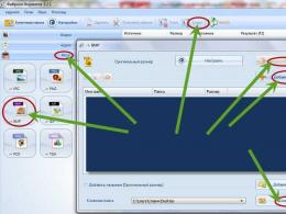
So let's install Marble. We have a shortcut in the form of a compass. We launch our software. Then, we pay attention to left menu. We select the map, the Earth and in the "Design" OpenStreetMap. Then, with the mouse, we zoom in on the settlement we need. For example, one of the districts of Volgodonsk will look like this.

You can get directions on the map. To do this, in the "Route" menu, select point A, then B. We put them on the map. Choose, Car, Pedestrian or Bicycle. Click "Get Route".

Our route is marked with a blue line. Unfortunately, sometimes the program slows down. In this case, it is recommended to install a newer version.

You can enable uploading user photos (available in a newer version).
Ancient maps of Earth, Moon and Mars
This is one of the most interesting moments. You can see what the maps looked like from the end of the 15th century. So, let's see what cards are available to us in the program menu. To do this, select "Design" in the left column. Next, I will open the Earth globe for 1570. You can twist it, zoom in or out.
An incomprehensible continent (Hyperborea?) is again shown in the Arctic Ocean. Antarctica looks huge and is connected to Australia.

Not all types of cards are presented on the supplied program. To see others, select "file", "upload data".

We get to the page of the site, which presents a variety of maps of both the Earth and other planets for different periods. Download the ones you need.

Then, unzip the files and install in installed folder Marble. Namely, in the maps folder.

Moreover, we insert the maps of the Earth separately into the earth folder, the moon into moon, Mars into mars (who knows English, will figure it out quickly) and other planets also separately. You can see how beautiful the lights of the night earth look from a cosmic height.
Or what Eurasia looks like by climatic zones. For example, it becomes clear that almost all of Scandinavia, Karelia and Siberia are located in the Arctic polar zone, and St. Petersburg is located next to it.

I advise you to take a closer look at other planets in this virtual globe. Believe me, they look very nice! Good luck!
For free observation of the Earth's surface and viewing satellite images online, you can use several applications. In Russia, two of them are most popular: Google Maps and Yandex Maps. Both services boast good quality high-resolution satellite images of most countries.
Yandex maps is an online application from Russian developers, so the cities of Russia are more accurately worked out in it. It has built-in functionality for viewing traffic congestion data (large settlements), demographic and geodata. Google maps have no less high-quality satellite images of the territory of the Russian Federation, but data on land and traffic are available only for the United States.
Watch a map of Planet Earth from a satellite online
Below you can see the Google map embedded on the site. For more stable operation of the plugin, we recommend using a browser Google Chrome. If you see an error message, then update the specified plugin, then reload the page.
Watch Google Earth from satellite, in real time online:
Another advantage of Google Maps is the presence of a client application for working with satellite images. This means that access to the service can be obtained not only through a browser, but also through a previously downloaded program. It has much more opportunities for viewing and studying satellite images, working with a three-dimensional virtual globe.
Google 3D satellite map (downloadable app, not online version) allows you to:
- use a quick search for the desired objects by name or coordinates;
- take screenshots and record high quality videos;
- work offline (preliminary synchronization via the Internet is required);
- use a flight simulator for more convenient movement between objects;
- save "favorite places" for quick movement between them;
- view not only the Earth's surface, but also images of other celestial bodies (Mars, the Moon, etc.).
Work with satellite maps Google is available through the client application or browser. On the official page of the program, a plugin is available that allows you to use interactive map on any web site. It is enough to embed its address in programming code site. For display, you can select both the entire surface and a specific area (you will have to enter the coordinates). Management - using a computer mouse and keyboard (ctrl + mouse wheel to zoom, cursor to move) or using the icons indicated on the map ("plus" - zoom in, "minus" - zoom out, move with the cursor).
The Google Earth real-time service allows you to work with several types of maps, each of which reflects certain data on satellite images. It is convenient to switch between them “without losing progress” (the program remembers where you “were”). Available view modes:
- satellite landscape map (geographical objects, features of the Earth's surface);
- physical map (detailed satellite images of the surface, cities, streets, their names);
- schematic geographic map for a more accurate study of surface images.
A satellite image is automatically uploaded at the point of approach, so a stable Internet connection is required to work. For Google's work Planet Earth in offline mode, you need to download an application for Windows or another operating system. Its operation also requires the Internet, but only for the first launch, after which the program synchronizes all the necessary data (satellite images of the surface, 3D models of buildings, names of geographical and other objects), after which it will be possible to work with the received data without direct access to the Internet.
Screenshot from google apps Earth
We live in an age of development information technologies. Computer modelling provides scientists and enthusiasts with a huge field for creativity and scientific research. Today, on a computer monitor, you can recreate processes or phenomena, the study of which in real conditions difficult or impossible due to their duration, size or other parameters.
More than just a globe
One of these successful projects in the field of modeling is the development by Google employees of an interactive model of the planet Earth, as well as its further development - a model of the starry sky. Thanks to satellite photography with high resolution images, a virtual globe opens up before users. Interactive Earth Model - Google Earth allows you to travel around the planet with simple mouse movements. Mouse wheel rotation or double tap allows you to zoom in on individual regions of the globe. You can zoom the image to the scale of the country, region, cities and even individual streets.
Images are uploaded via active Internet access. Borders, names of countries, cities and other geographical objects are applied to photos interactively. The navigation bar in the upper right corner also allows you to change the scale and orientation of the globe.
Many people not only study, but also take a great interest in geography and astronomy. These are really very interesting sciences. Especially if there is everything you need for an exciting and visual study. For example, today it is very easy to find online 3D model of the solar system. Which will allow you to observe the movements of the planets, the movements of satellites and other space objects. 
Today we will consider the service of a slightly different plan. This is a 3D Earth globe online. Who will be interested in it? First of all, those people who love to observe directly our planet, but also do not forget to admire the beauties of the surrounding space.
How to launch the 3D Earth Globe online application
Finding this very interesting, visual and effective application is very simple - just use the help of our site, which is ready to offer to go to .
If everything was done correctly, then the screen will display 3D image our home planet, surrounded by stars, and illuminated by the Sun.


It is very easy to work with 3D online world globe:
- Enough to move computer mouse to change the viewing angle to the celestial body.
- There are several additional options display of our planet. To do this, just use one of them. To select, just click on the desired option, which is located in the upper right corner of the screen.